GPS was first introduced in the 1970s by the U.S. Department of Defense. By 1993 it was a 24-satellite system orbiting 20,200 KM over the Earth. Arranged in fixed groups of six, these satellites inclined at 55 degrees to the Equator. Moreover, GPS receivers process signals from these satellites to determine their position.
Today, you use GPS in your car’s sat-nav, on your smartphone’s map applications, and for fitness tracking apps. But have you ever wondered what the frequency of GPS is? How far can it go, and how many frequencies does GPS have?
Read on to find out more.
Table of Contents
- How Many Frequencies Does GPS Have?
- What Are the Benefits of Using the Different GPS Frequencies?
- How Does GPS Work/How Is the GPS Signal Transmitted?
- Examples of GPS?
- FAQs
- Conclusion
How Many Frequencies Does GPS Have?
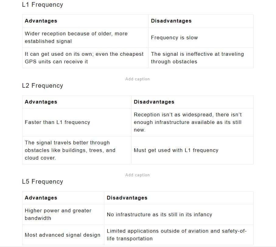
All GPS satellites broadcast signals on a minimum of two carrier frequencies. First, the L1 frequency broadcasts at 1575.42 MHz, while the L2 broadcasts at 1227.6 MHz. Some newer satellites use the L5 frequency, which is 1176 MHz.
Also, L1 remains the most popular of the three frequencies used in all GPS devices and equipment. L1 frequencies track the GPS satellite location. L2 frequency monitors the health of the GPS satellites. L5 frequency has civilian applications, such as precision landing and aircraft guidance.
What Are the Benefits of Using the Different GPS Frequencies?
Each GPS frequency offers unique features that come with advantages and disadvantages. First and foremost, the L1 frequency is the oldest GPS signal, with military and civilian applications. L2 is newer and more robust than L1, also used for civilian and military purposes. L5 is the latest and most advanced GPS frequency. However, it’s still in its early stages of use for particularly demanding applications like aviation.
How Does GPS Work/How Is the GPS Signal Transmitted?
GPS systems work through a network of satellites orbiting the Earth. The satellites give you information on timing, positioning, and navigation by sending signals to a receiver on Earth. Not only does this mean that if you have a sensor or receiver, but also you can track your movement to your precise location.
There are 3 parts to the GPS system:
Space Segment
This comprises 31 satellites orbiting the planet at 20,000KM. Each satellite sends microwave signals that get picked up by preset receivers. Therefore these satellites have atomic clocks built into them, synchronized with clocks on Earth.
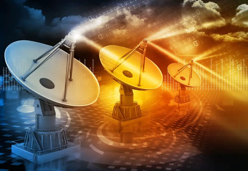
Satellite dish transmission data
Ground Segment
Also known as the control segment, this part works like a tower station. Ground segments monitor the satellites, ensuring they function correctly. In addition, they keep track of satellite movements and transmissions and perform analyses.
Besides, control segments also communicate with the satellite. They ensure that information transmitted to receivers remains as accurate as possible.
User Segment
You’ll find user segments or receivers in your smartphone and the trackers of your daily-use devices. They’re used in every industry. From the military and law enforcement to aviation, transport, agriculture, and automobiles. GPS receivers comprise a processor and antenna.
Particularly, antennas get tuned to receive the frequency of signals transmitted from satellites. Therefore, the processor decodes and interprets the information using a process called trilateration. Each receiver has a clock that records the time signals get detected.
Examples of GPS?
Google Maps
Google Maps location service is the most commonly used civilian GPS. It’s powered by the Google cloud platform and gets employed worldwide. The most popular services are street view, business listing, and traffic updates.
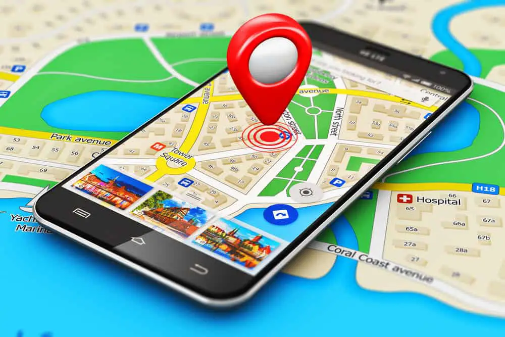
Mobile GPS navigation concept
Verizon Connect
Verizon Connect is a precise tracking tool that simulates the daily operations of vehicle fleets. It especially improves the productivity and safety of drivers while keeping you informed on maintenance and repairs. Nonetheless, Verizon Connect lets you identify the best routes, improve delivery and asset tracking, and even track driver behavior.
Printed circuit board
NAVSTAR GPS
Operated by the U.S. Department of Defense, NAVSTAR GPS has military applications. It’s used for specialized operations and tracking targets.
FAQs
W
Types of GPS Available?
The most common type of GPS is sat-nav, installed in vehicles to offer street navigation. Moreover, modern phones also come equipped with GPS. Sports buffs use GPS watches for runs, hikes, and sailing.
How Many Satellites Are in the GPS Constellation?
There were 26 satellites in the GPS constellation as of June 26, 2022. However, this figure did not include decommissioned satellites or on-orbit spare satellites.
How Accurate Is the GPS?
Several factors affect GPS accuracy. This includes atmospheric conditions, receiver design, and satellite geometry. Therefore, GPS is fairly accurate and only gets affected by obstacles that cause signal blockages.Things like trees, bridges, cloud cover, and buildings cause blockages.
Wireless vector
Who Uses GPS?
The military, law enforcement, and space agencies like NASA use GPS. GPS systems are also used in the automotive, agriculture, emergency service, and mining industries.
Conclusion
It’s hard to imagine life without GPS. Navigating your surroundings would become a lot more complex, and many daily tasks would get affected by its absence.
Nonetheless, militaries, corporations, farmers, and ordinary people rely on GPS to communicate, identify locations, and track items. With the advent of L5 GPS frequencies, the future of this sector is set to become even more prominent. Thus, opening up a new world of possibilities for its use.
You can look forward to a more sophisticated and effective GPS network.
