
If you turn on the terrain feature in Google Maps, you will see the elevation of the landmass, but only in mountainous areas.
So are there GPS elevation apps that can give you accurate elevation values while helping you navigate? Let’s find out!
Table of Contents
- Difference Between Elevation and Altitude
- Best GPS Elevation Apps
- How Devices Calculate Elevation
- Conclusion
Difference Between Elevation and Altitude
Before we get into the apps, let’s clarify what elevation and altitude mean. Most people use the terms interchangeably. But they don’t mean the same thing.
Elevation refers to the geographical height of points on the earth’s surface. In this case, we consider the sea level the zero elevation point.
So it specifies the height at which objects rise from the sea level (0 meters).
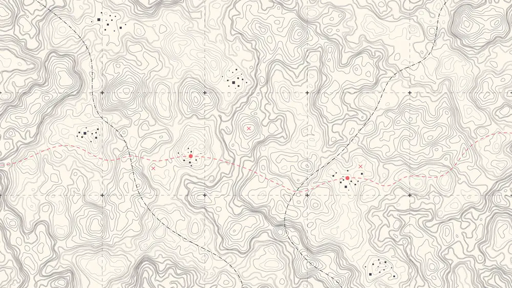
A topographic map showing elevation lines
On the other hand, altitude refers to the height of a place or object above the planet’s surface. And it also uses the sea level as the reference plane.
Airplanes use height above ground level measurements to maintain a safe distance above the surface when flying.
GPS elevation apps can help you plan or record hikes and rides, showing you the distance you’ll cover, the direction to go, and the height differences of the path.
Most maps, including Google Maps, indicate the terrain using contour/elevation lines.
But you might need an app that shows the exact elevation reading of your intended travel path or current spot.
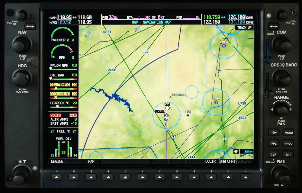
An airplane’s glass cockpit display with terrain data
Best GPS Elevation Apps
We will look at three apps that indicate your current elevation and show elevation profiles for climbs and descents.
Compass App
As the default compass app for Apple devices, this app is available only for iPhones (iOS 12 or later) and Apple watches (watchOS 6 or later).
With the location services turned on, your device can lock onto GPS satellites and display your location coordinates in real-time.

A female hiker checking her smartwatch at a mountaintop
Also, you can lock into your current direction by tapping the compass dial, and the app will display a red band when you go off course.
You can open your exact location coordinates in Maps by tapping the coordinates values at the bottom of the screen. And below the coordinates are the ground elevation readings indicated in feet.
GPS Elevation App: Ride with GPS
Ride with GPS is ideal for bike navigation and does a better job of providing detailed elevation data to the user.
Plus, it is available on the Google Play and Apple App Store.

A mountain bike rider on a trail high up in the mountains
The application provides a mobile route planner with audible voice navigation and shareable live tracking to show your family and friends where you are on the route.
And once you plan the route, the app shows a graph of the elevation profile along the way. This profile gives you an idea of the hills and descents you’ll encounter.
You can pan and zoom in to see the exact points on the map where these hills and descents occur.
Although you can use the app for free, Basic and Premium subscriptions have the added advantage of downloading offline maps and routes.
So you won’t need an active internet connection and can venture deep into the trails, where there is limited cell reception, while still getting GPS navigation.
GPS Elevation App: My Elevation
Instead of using the phone’s sensors and GPS data to get the elevation, My Elevation relies on web services to get the precise surface elevation of your current location.
These web services are more accurate than the other data provided by your device.
However, this mechanism has some downsides. First, it needs an active data connection to show your map position and get accurate elevation data.
Secondly, it can only give the surface elevation.
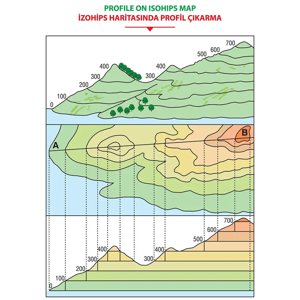
A contour and elevation map showing the elevation lines and numbers
The app can show four map types (normal, topo, satellite & hybrid) and allows you to add bookmarks of favorite places plus share your location.
Also, you can search for locations, and the app will inform you of the details of that location.
Long pressing on any point on the map also shows the weather and lets you browse Wikipedia articles about tourist attractions nearby.
Once you start the journey, the Follow Me mode follows your current location in real-time and observes your movements on the map.
Therefore, it can be handy for creating a detailed travel profile afterward.
GPS Elevation App: Other Options
You can use altimeter apps because there is no difference between altitude and elevation at ground level. The differences arise if you fly or go up a building.
How Devices Calculate Elevation
Most modern phones have barometric pressure sensors that measure atmospheric pressure. Gravity pulls everything, including the atmosphere, towards the earth’s center.
So the atmospheric pressure increases as altitude/elevation decreases. By measuring the air pressure changes, your phone can determine how far high or low you’ve traveled.
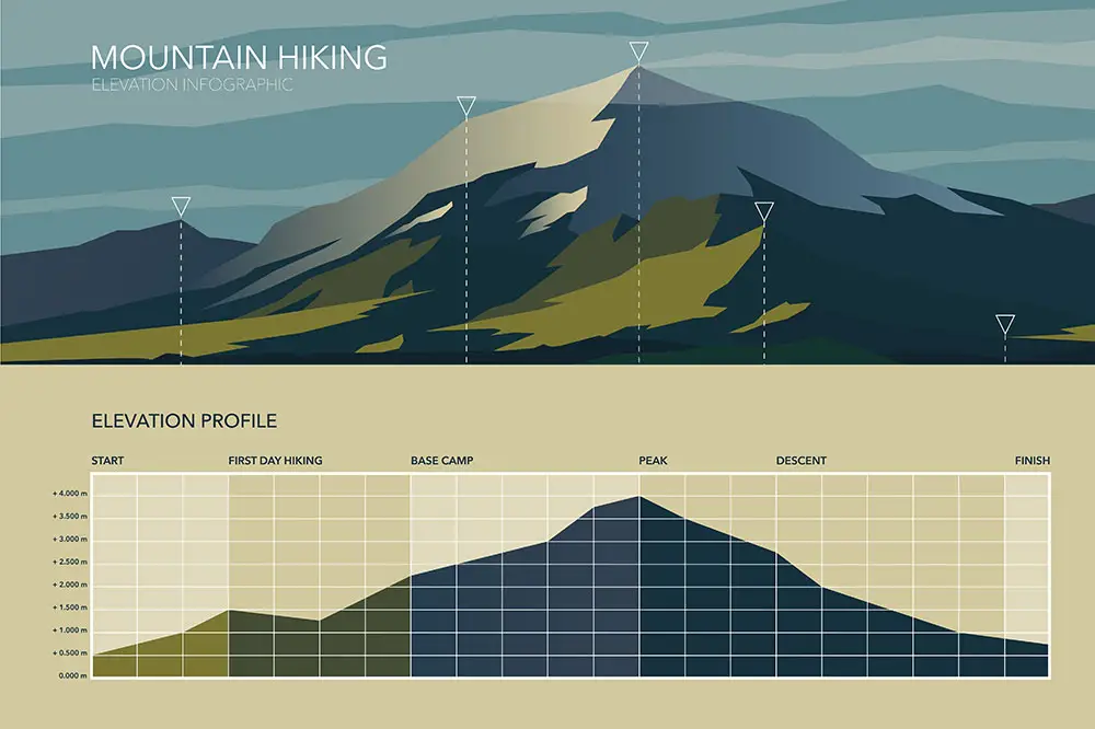
A mountain’s elevation profile
However, weather can affect atmospheric pressure, so most apps also try to get current air pressure data from meteorological stations nearby for comparison and calibration.
GPS data also gives altitude information. So your phone can calculate its altitude if it has a decent GNSS chipset.
Remember, elevation and altitude are equal if you are directly above the surface. So when holding your phone about a meter above the ground, the percentage variation will be negligible.
Conclusion
As you can see, elevation is a critical factor to consider if you want to plan or record detailed hike/cycling routes because the variable shows ascent and descent data.
And you can use the apps listed above to get this data when planning your routes or to get elevation data when on the trail in real time.
We hope this article has been insightful. Leave a comment below to share your sentiments.